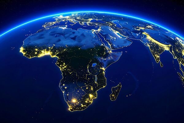
Accra / Nairobi / Lagos — In what could become one of the most transformative data-driven infrastructure projects on the continent, an ambitious partnership backed by Abu Dhabi’s Space42, Microsoft and Esri aims to create a continually refreshed, high-resolution digital map of Africa’s 54 nations — a tool proponents say could reshape economic planning, climate action and commercial expansion across the continent.
The initiative, known as Map Africa, seeks to overcome long-standing gaps in geospatial data that have limited governments, investors and planners to fragmented, outdated base maps. By integrating satellite imagery, artificial intelligence (AI), cloud computing and local capacity building, the project will attempt nothing less than a live, continent-wide digital geospatial platform, offering real-time insights into urban growth, infrastructure, agriculture, disaster risk and more.
A Continental Basemap Built for Tomorrow
At the core of Map Africa is an expansive vision: build a digital foundation for planning and investment that transcends national borders and bespoke datasets. Today, much of Africa’s geospatial information is piecemeal — driven by short-term humanitarian or research projects — with limited interoperability and inconsistent coverage.
“We use Earth observation satellites to capture images with centimetre-level accuracy,” explains Yuliya Tarabalka, vice-president of Geospatial and Smart Solutions at Space42. “Once captured, AI converts raw imagery into usable map layers: terrain, roads, buildings, boundaries, vegetation — all the foundational data essential for informed decision making.”
Under the terms of the MoU signed in July 2025, Space42 will provide satellite imagery and lead overall project coordination; Esri, a global mapping software leader, will manage geospatial data workflows and visualization; and Microsoft will host and scale the system on its Azure cloud platform. Governments will hold licenses to the data, enabling national ownership and long-term updating by local mapping agencies.
From Governments to Startups: Broad Economic Impact
Proponents emphasise that the Map Africa platform is not a static resource but an engine of economic value across sectors. Governments could use live basemaps to optimize infrastructure investments, plan smart cities, monitor water resources, model climate risk and enhance disaster response — capabilities that have traditionally been constrained by outdated or incomplete maps.
Private industry is also poised to benefit. Telecommunications firms, insurers, agricultural firms, logistics operators and energy developers rely on precise geospatial data to reduce risk, streamline operations and expand services. By offering high-quality, continuously updated maps, Map Africa could underpin new commercial services and tech startups that deliver data-driven solutions across the continent.
African experts say the effect could be profound. “We have a booming young population looking for jobs,” notes Yaw Nyarko, an economist at New York University’s Africa House. “These maps will not only improve planning and investment; they will provide entry-level and high-value jobs in data collection, analysis, and applied geospatial research.”
Harmonisation, Local Capacity and Long-Term Sustainability
One of the initiative’s biggest challenges — and strongest commitments — is to build regional capacity and harmonise institutions. The Map Africa strategy includes establishing “centres of excellence” in select countries that will serve as hubs for training, validation and applied research, ensuring that African governments and businesses can maintain and grow their geospatial ecosystems.
This emphasis on local participation is critical in a continent where national regulations on data governance vary widely, and where previous mapping efforts, although valuable, have often operated in siloes.
By 2030, project planners expect full continental coverage — meaning every country will maintain its own live base map connected to a shared infrastructure and supported by local teams trained in advanced geospatial science.
Strategic Dimensions and Future Prospects
Map Africa arrives amid a broader surge in technology and infrastructure collaboration between African governments and international partners. The United Arab Emirates, for example, has rapidly expanded its investment footprint, committing over $110 billion to African projects between 2019 and 2023, with significant funds targeting green energy and digital infrastructure.
Critically, the project reflects a shift in how data — especially geospatial intelligence — is being valued as infrastructure in its own right. If successful, Map Africa could become a keystone platform for regional integration, climate adaptation, urbanization strategy and private sector growth across Africa, setting a new standard for how populated and dynamic regions leverage digital earth observation to power economic and social transformation.